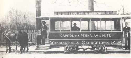
This line was converted to cable in 1892 and electrified before 1899[3]
Development
L'Enfant's plan conceived a substantial city, but until the Civil War Washington was more of a southern town. By the 1860 census the population of the District had reached only 75,000. In the northwest there was no real urban development north of Rhode Island Avenue, the northeast had no development more than four blocks from the Capitol, and the southeast had virtually nothing north of Pennsylvania Ave. Much of the planned city remained woods, orchards or farms.
All this changed with the Civil War. First, there were two major military installations in the area (Second Division between Q & R, 16th and 20th, and Third Division between Q & R, 3rd & 10th)[1], and some camps for former slaves who sought protection behind Union lines. Then in 1867 Howard University was chartered and quickly became a center of new development. Government and contractor employment ballooned during the war, with much of the employment remaining after the war in new agencies such as the Freedmen's Bureau and later the Pension Office.[2]
|
|
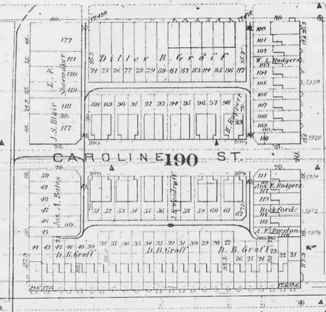
There was a definite need for more housing, and north was the only direction to spread without bridges or ferries. The 14th Street corridor was a major center of activity, as a horse-drawn streetcar line had been built in 1863. Diller B. Groff was one of the speculators who stood ready to make his mark (and fortune) in development. And to maximize return (or create some more affordable housing - take your pick), many of the squares of the L'Enfant Plan were cut in two to increase the number of lots. Thus were Corcoran, Riggs, Swann, Caroline and other named streets between the letter or number streets added to the map. The map by G. M. Hopkins for the year 1887 shown below shows a new subdivision for 190, with Caroline Street and its new lot configuration. The lot numbers from the 1887 map are still used today to define legal property locations in square 190 on Caroline, most of 15th, and most of T. The entire 16th Street side was later replatted (subdivided).
|
The property owners' names on the 1887 plat show that developer Groff was still busy in the neighborhood. He appears as the owner of the entire north side of the 1500 block of T Street and of the south side of U Street. A new alley system is shown serving Caroline and adjacent T and U Streets, as are the footprints of the two styles of houses - indented and flat fronts - that Groff built on the Caroline. The footprints of other nearby houses - planned or in existence - are also shown. Note that none of the lots facing 16th and half of those facing U had yet been developed.
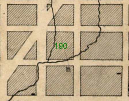
It is not known whether early residents of Caroline Street experienced problems with damp basements or actual water in them during severe rainfall as some current residents have. There was, however, a stream called Slash Run that coursed down the escarpment and crossed the southeast corner of Square 190 on its meandering way to Rock Creek. (The word "slash" is a colliquial expression for the word "stand," and refers to the stands of white oak trees that covered the lower slopes where water ran down the escarpment.[5])
|
[1] 1876 Map of Washington by Morrison, posted at http://www.dcpages.com/Tourist/dc1876.html
[2] The population of the City of Washington (not the whole District) was 61,122 in 1860, was 109, 199 in 1870, and had grown to 177,624 in 1880. City of Magnificent Intentions, The D.C. History Curriculum Project, Associates for Renewal in Education, Washington, D.C., 1983, p. 71; DC Office of Planning.
[3] 100 Years of Capital Traction by LeRoy O King, published by the author in Dallas, Texas, in 1972. The photo was originally published by Handy Studios.
[4]
Detail from G M Hopkins Survey Map, Philadelphia, PA, 1887.
[5] Don Hawkins, "The Landscape of the Federal City." Washington History, Special Bicentennial Edition, Vol. 3, No. 1, Spring/Summer 1991, p. 21.
[6] Detail from Topographical map of the District of Columbia surveyed in the years 1856 '57 '58 & '59 by A. Boschke; engraved by D. McClelland, Washington, D.C.
Last update 11 July 2004
Copyright Richard Busch, 1993, 2004-5
Blanket permission for downloading and reproduction for personal use is given.
Any commercial use without explicit written permission is prohibited.
home | previous page - the plans | next page - Diller B. Groff | contact